Main Content
Learn about the Python programming language and its many uses for geoprocessing and data processing automation in the ArcGIS ecosystem by taking this online evening course!

Jump to: Overview | Instructor | Reviews | CE Credits | Contact Us | Related Courses | Join Email List
Course Details
Course Name: Introduction to Python in ArcGIS
Course Code: EG0922WA24
Date of Most Recent Offering: March 5, 12, 19, and 26, 2024 (Tuesdays) Canceled
Course Overview
Learn about the Python programming language and its many uses for geoprocessing and data processing automation in the ArcGIS ecosystem! This class is geared towards working professionals with some familiarity with ArcGIS, ArcMap, and ArcGIS Pro.
Featured Topics
- Using Python in ArcMap/ArcGIS Pro
- Writing Your Own Python Scripts
- Using the ArcPy Module in ArcGIS
- Creating a Script Tool
- Automating GIS Administration in ArcGISOnline
- Using Conda for Python Environments
ArcGIS Pro Software Access
All participants in this course will receive access to the ArcGIS Pro software during the class and for one month following the conclusion of the course.
Prerequisite
ArcGIS: Introduction or some related experience working with ArcMap or ArcGIS Pro is highly recommended. Knowledge of basic GIS data types, layers, and geoprocessing tools is preferred.
Who Should Attend?
This class is recommended for individuals with prior knowledge of ArcGIS, ArcMap, and ArcGIS Pro who want to learn how the Python programming language can enhance their use of ArcGIS Pro. Past participants have included:
- Environmental Scientists
- Geologists
- Project Professionals
- Water System Distribution Technicians
Meet Your Instructor
Chris Klaube, Solutions Architect at Langan Engineering and Environmental

Chris Klaube is an experienced GIS professional and software engineer with a Masters in Geographic Information Systems. He has a deep knowledge of the Esri software suite and enterprise GIS systems, as well as web development using the Esri SDK’s. Chris has worked in various roles within GIS for the last 14 years, including as a GIS analyst, GIS systems administrator, and developer. Chris currently works as a Solutions Architect for Langan Engineering and Environmental where he is primarily involved in GIS enterprise management, cloud services and custom application development.
Continuing Education Credits
The Introduction to Python in ArcGIS course is approved for 1.4 Rutgers CEUs (14 contact hours), as well as the following credits from professional organizations.
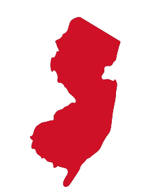 New Jersey
NJ Health Officers and Registered Environmental Health Specialists (HO/REHS): Rutgers University, NJAES, Office of Continuing Professional Education has been approved by the New Jersey Department of Health as a provider of NJ Public Health Continuing Education Contact Hours (CEs). Participants who complete this education program will be awarded 6.0 NJ Public Health Continuing Education Contact Hours (CEs).
NJ Professional Engineers: 14 Continuing Professional Competency (CPC) credits
Program Questions? We’re Here to Help!
If you have any questions about Introduction to Python in ArcGIS, please don’t hesitate to reach out to us.
Senior Program Coordinator: Suzanne Hills
848-932-7234
suzanne.hills@rutgers.edu

Administrative Assistant: Samantha Thompson
848-932-7764
samantha.thompson9@rutgers.edu
For registration assistance, please contact our Registration Department at 848-932-9271, option 2 or email registration@njaes.rutgers.edu.
Explore Related Programs